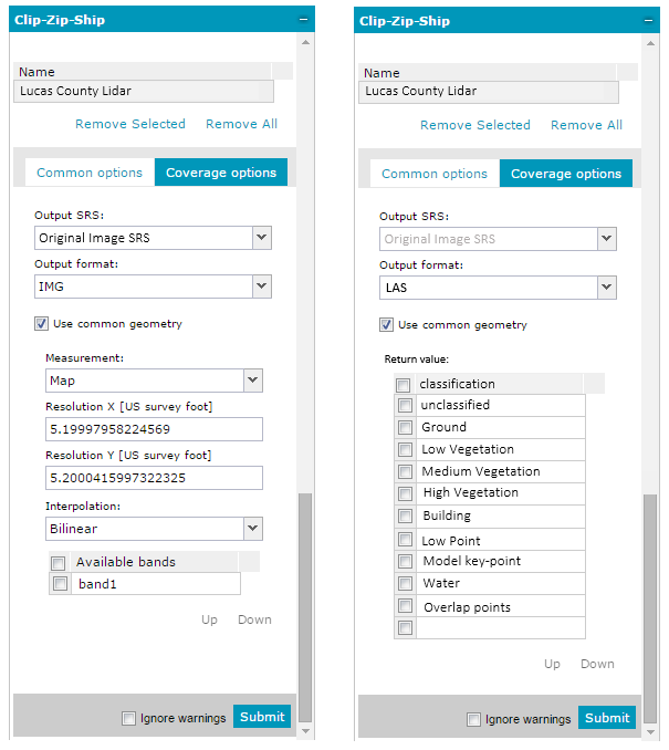
The LAS output format is available only for LIDAR datasets. When LAS is selected in the Coverage options sub tab, parameters different from those of other output formats can be set. Below is the comparison of Coverage options for IMG and GeoTIFF (left) and LAS (right) format:
The following are the parameters available on the Coverage option sub tab when the LAS output format is selected:
SRS - EPSG code (the same as for raster data).
Geometry – Use the Geometry drop-down list to choose between a rectangle (bbox) and a polygon.
Format – List of output formats that are the same as for raster data plus LAS.
Return value – A (text) field where you can insert a natural number that corresponds to the order number of the reflected signal.
Classification – You can select which LIDAR classifications to keep when you want to subset and download the LAS file. Possible values for classification: