![]() This section is valid for all product flavors.
This section is valid for all product flavors.
Geospatial Portal provide a range of tools for performing measurements on the map. The measurements can be performed in both Geospatial Portal view modes: 2D and 3D. Tools for measuring distance, area, and points (read point coordinates) are grouped on the toolbar in the Measurements tab.
Icon |
Name |
Description |
|
Measure point |
Lets you read the geographical coordinates of a designated point. Coordinates of a point are displayed on the map. |
|
Measure distance |
Lets you measure the distance between two points or multiple points. |
|
Measure area |
Lets you measure the polygon area. Distance between points is also measured. |
|
Clear measures |
Clears all measurements from the map. |
|
Show/Hide Measurements |
Toggles on/off the visibility of labels with the values for the measured objects. |
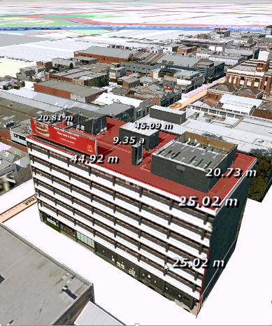
Below are the pictures showing the sample measurements performed on a 2D map and 3D object.
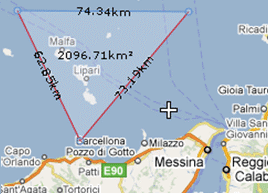 5
5
![]() The measurements can be performed in metric or imperial units. User can choose the type of units on the Settings tab using the System of measurement pull down list.
The measurements can be performed in metric or imperial units. User can choose the type of units on the Settings tab using the System of measurement pull down list.