.
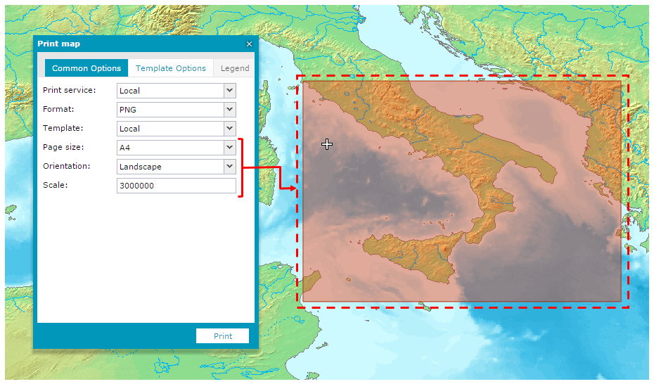
.- Common Option tab:
- Print service – Local for the Geospatial Portal internal printing.
- Format – Graphic file type into which the map you are printing will be saved. The PNG file format is available with Local Print Service.
- Template – Print template. One (Local) predefined template is available.
- Page size – Select the page size from available sizes in the pull-down list.
- Orientation – Options include Landscape or Portrait.
- Scale – Provide the scale for the printed map.
- Template Options tab:
- DPI – Set print resolution in DPI units. Using Local Print Service, the map can be printed with 150 or 96 DPI resolution.
![]() The rectangle (printed area) size changes when you change the page size, orientation, or scale.
The rectangle (printed area) size changes when you change the page size, orientation, or scale.